Calculate Route
gem_kit package.
|
|||
Setup
Prerequisites
Build and Run
Navigate to the route_calculation directory within the Flutter examples directory. This is the project folder for this example.
Note - the gem_kit directory containing the Maps SDK for Flutter
should be in the plugins directory of the example, e.g.
example_pathname/plugins/gem_kit - see the environment setup guide above.
Run: flutter pub get
Configure the native parts:
First, verify that the ANDROID_SDK_ROOT environment variable
is set to the root path of your android SDK.
In android/build.gradle add the maven block as shown,
within the allprojects block, for both debug and release builds:
allprojects {
    repositories {
        google()
        mavenCentral()
        maven {
           url "${rootDir}/../plugins/gem_kit/android/build"
        }
    }
}
in android/app/build.gradle
within the android block, in the defaultConfig block,
the android SDK version minSdk must be set as shown below.
Additionally, for release builds, in android/app/build.gradle,
within the android block, add the buildTypes block as shown:
Replace example_pathname with the actual project pathname
android {
    defaultConfig {
        applicationId "com.magiclane.gem_kit.examples.example_pathname"
        minSdk 21
        targetSdk flutter.targetSdk
        versionCode flutterVersionCode.toInteger()
        versionName flutterVersionName
    }
    buildTypes {
        release {
            minifyEnabled false
            shrinkResources false

            // TODO: Add your own signing config for the release build.
            // Signing with the debug keys for now, so `flutter run --release` works.
            signingConfig signingConfigs.debug
        }
    }
}
Then run the project:
flutter run --debugorflutter run --release
App entry and initialization
const projectApiToken = String.fromEnvironment('GEM_TOKEN');

void main() {
  runApp(const MyApp());
}
This code initializes the projectApiToken with the required authorization token and launches the app.
How It Works
The example app demonstrates the following features:
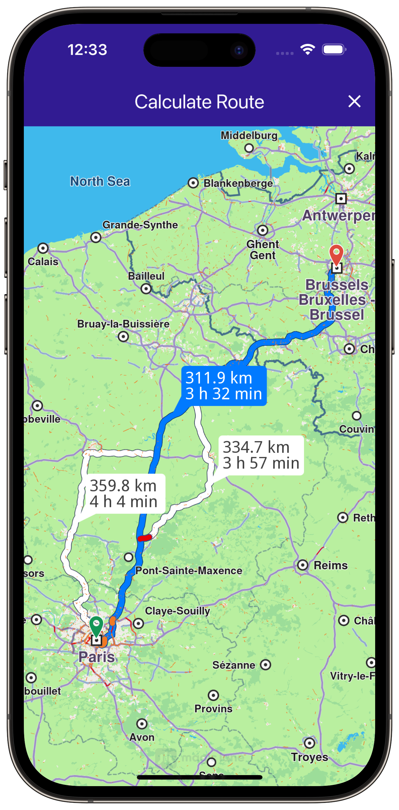
Calculate a route between two landmarks.
Display the route on a map and allow user interaction with the route.
Provide options to cancel route calculation or clear the routes from the map.
|
|||
UI and Map Integration
class MyApp extends StatelessWidget {
  const MyApp({super.key});

  @override
  Widget build(BuildContext context) {
    return const MaterialApp(
      debugShowCheckedModeBanner: false,
      title: 'Calculate Route',
      home: MyHomePage(),
    );
  }
}

class MyHomePage extends StatefulWidget {
  const MyHomePage({super.key});

  @override
  State<MyHomePage> createState() => _MyHomePageState();
}

class _MyHomePageState extends State<MyHomePage> {
  late GemMapController _mapController;

  TaskHandler? _routingHandler;
  List<Route>? _routes;

  @override
  void dispose() {
    GemKit.release();
    super.dispose();
  }

  @override
  Widget build(BuildContext context) {
    return Scaffold(
      appBar: AppBar(
        backgroundColor: Colors.deepPurple[900],
        title: const Text('Calculate Route',
            style: TextStyle(color: Colors.white)),
        actions: [
          // Routes are not built.
          if (_routingHandler == null && _routes == null)
            IconButton(
              onPressed: () => _onBuildRouteButtonPressed(context),
              icon: const Icon(
                Icons.route,
                color: Colors.white,
              ),
            ),
          // Routes calculating is in progress.
          if (_routingHandler != null)
            IconButton(
              onPressed: () => _onCancelRouteButtonPressed(),
              icon: const Icon(
                Icons.stop,
                color: Colors.white,
              ),
            ),
          // Routes calculating is finished.
          if (_routes != null)
            IconButton(
              onPressed: () => _onClearRoutesButtonPressed(),
              icon: const Icon(
                Icons.clear,
                color: Colors.white,
              ),
            ),
        ],
      ),
      body: GemMap(onMapCreated: _onMapCreated, appAuthorization: projectApiToken),
    );
  }
This code sets up the basic structure of the app, including the map and the app bar. It also provides buttons in the app bar for building, canceling, and clearing routes.
Route Calculation and Map Interaction
// The callback for when map is ready to use.
void _onMapCreated(GemMapController controller) {
  // Save controller for further usage.
  _mapController = controller;

  // Register route tap gesture callback.
  _registerRouteTapCallback();
}

void _onBuildRouteButtonPressed(BuildContext context) {
  // Define the departure.
  final departureLandmark =
      Landmark.withLatLng(latitude: 48.85682, longitude: 2.34375);

  // Define the destination.
  final destinationLandmark =
      Landmark.withLatLng(latitude: 50.84644, longitude: 4.34587);

  // Define the route preferences.
  final routePreferences = RoutePreferences();

  _showSnackBar(context, message: "The route is being calculated.");

  // Calling the calculateRoute SDK method.
  // (err, results) - is a callback function that gets called when the route computing is finished.
  // err is an error enum, results is a list of routes.

  _routingHandler = RoutingService.calculateRoute(
      [departureLandmark, destinationLandmark], routePreferences,
      (err, routes) {
    // If the route calculation is finished, we don't have a progress listener anymore.
    _routingHandler = null;
    ScaffoldMessenger.of(context).clearSnackBars();

    // If there aren't any errors, we display the routes.
    if (err == GemError.success) {
      // Get the routes collection from map preferences.
      final routesMap = _mapController.preferences.routes;

      // Display the routes on map.
      for (final route in routes!) {
        routesMap.add(route, route == routes.first,
            label: route.getMapLabel());
      }

      // Center the camera on routes.
      _mapController.centerOnRoutes(routes: routes);
      setState(() {
        _routes = routes;
      });
    }
  });

  setState(() {});
}

void _onClearRoutesButtonPressed() {
  // Remove the routes from map.
  _mapController.preferences.routes.clear();

  setState(() {
    _routes = null;
  });
}

void _onCancelRouteButtonPressed() {
  // If we have a progress listener we cancel the route calculation.
  if (_routingHandler != null) {
    RoutingService.cancelRoute(_routingHandler!);

    setState(() {
      _routingHandler = null;
    });
  }
}
This code handles the calculation of routes between two landmarks, displays the routes on the map, and provides options to cancel or clear the routes. The map is centered on the calculated routes, and a label showing the distance and duration is displayed.
Route Selection
// In order to be able to select an alternative route, we have to register the route tap gesture callback.
void _registerRouteTapCallback() {
  // Register the generic map touch gesture.
  _mapController.registerTouchCallback((pos) async {
    // Select the map objects at given position.
    _mapController.setCursorScreenPosition(pos);

    // Get the selected routes.
    final routes = _mapController.cursorSelectionRoutes();

    // If there is a route at position, we select it as the main one on the map.
    if (routes.isNotEmpty) {
      _mapController.preferences.routes.mainRoute = routes[0];
    }
  });
}
This code enables the user to select a specific route on the map by tapping on it. The selected route becomes the main route displayed.
Displaying Route Information
// Define an extension for route for calculating the route label which will be displayed on map.
extension RouteExtension on Route {
  String getMapLabel() {
    final totalDistance = getTimeDistance().unrestrictedDistanceM +
        getTimeDistance().restrictedDistanceM;
    final totalDuration =
        getTimeDistance().unrestrictedTimeS + getTimeDistance().restrictedTimeS;

    return '${_convertDistance(totalDistance)} \n${_convertDuration(totalDuration)}';
  }

  // Utility function to convert the meters distance into a suitable format.
  String _convertDistance(int meters) {
    if (meters >= 1000) {
      double kilometers = meters / 1000;
      return '${kilometers.toStringAsFixed(1)} km';
    } else {
      return '${meters.toString()} m';
    }
  }

  // Utility function to convert the seconds duration into a suitable format.
  String _convertDuration(int seconds) {
    int hours = seconds ~/ 3600; // Number of whole hours
    int minutes = (seconds % 3600) ~/ 60; // Number of whole minutes

    String hoursText = (hours > 0) ? '$hours h ' : ''; // Hours text


    String minutesText = '$minutes min'; // Minutes text

    return hoursText + minutesText;
  }
}
This code defines an extension on the Route class that calculates and formats the distance and duration of the route for display on the map.


