Define Persistent Roadblock
In this guide you will learn how to render an interactively defined road block on an interactive map, and fly to the road block.
Setup
- Get your Magic Lane API key token: if you do not have a token, see the Getting Started guide.
- Download the Maps & Navigation SDK for Android archive file.
- Download the DefinePersistentRoadblock project archive file or clone the project with git.
- See the Configure Android Example guide.
Run the example
In Android Studio, from the File menu, select Sync Project with Gradle Files.
- An android device should be connected via USB cable.
- Press SHIFT+F10 to compile, install and run the example on the android device.
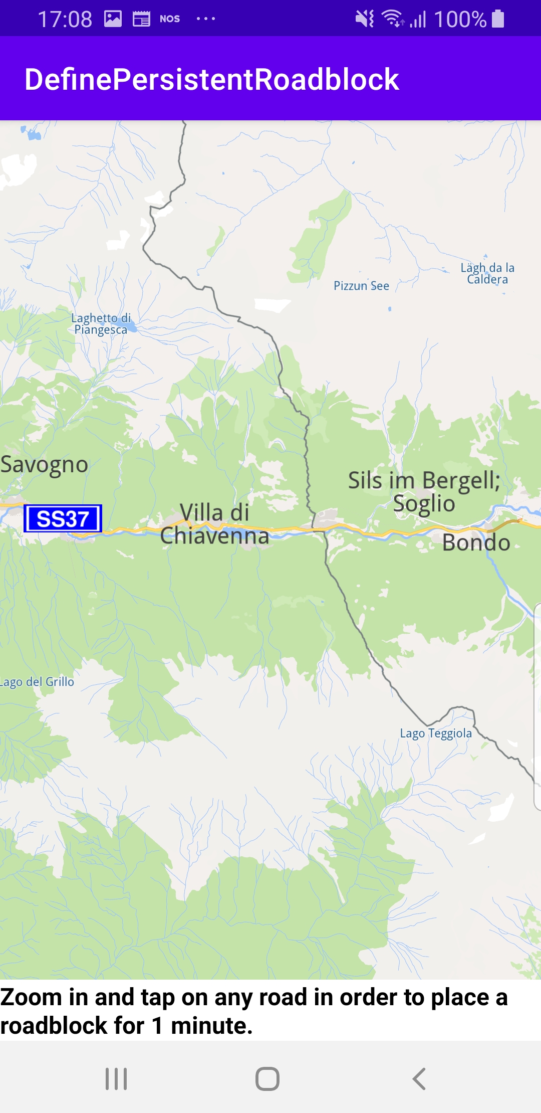
Once the map is loaded, zoom in and tap on a road to define a road block.
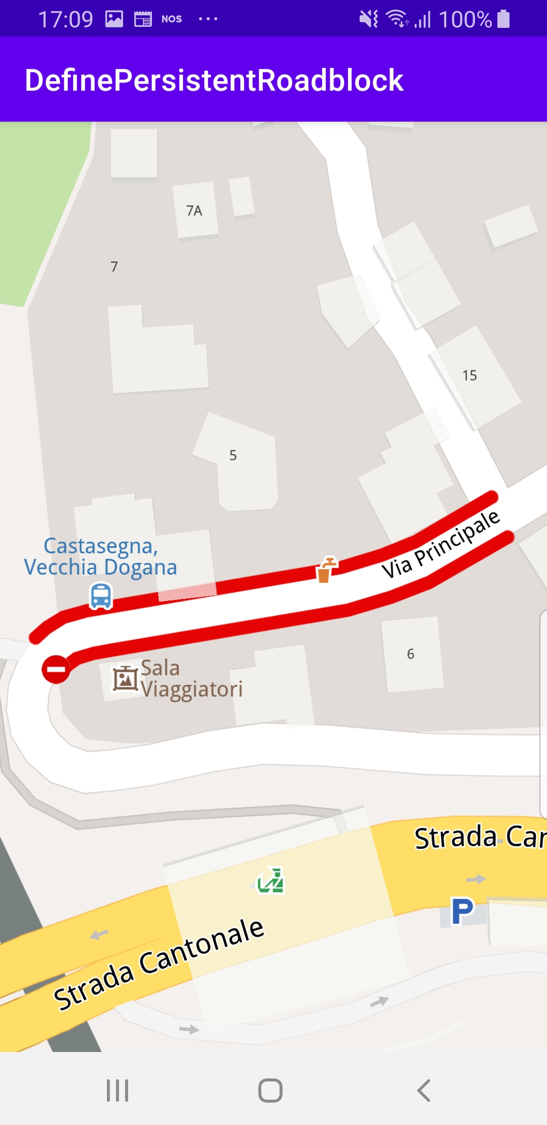
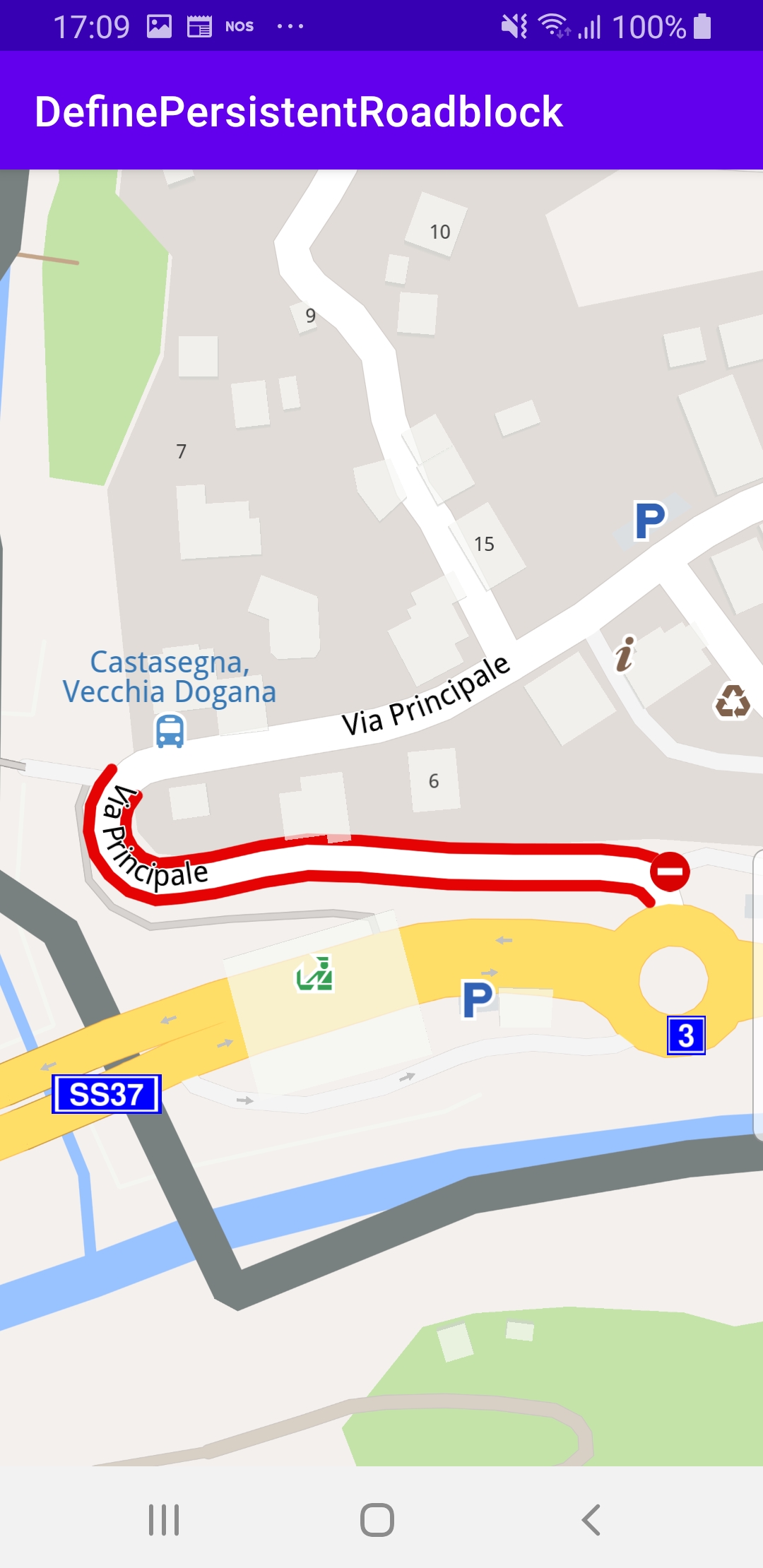
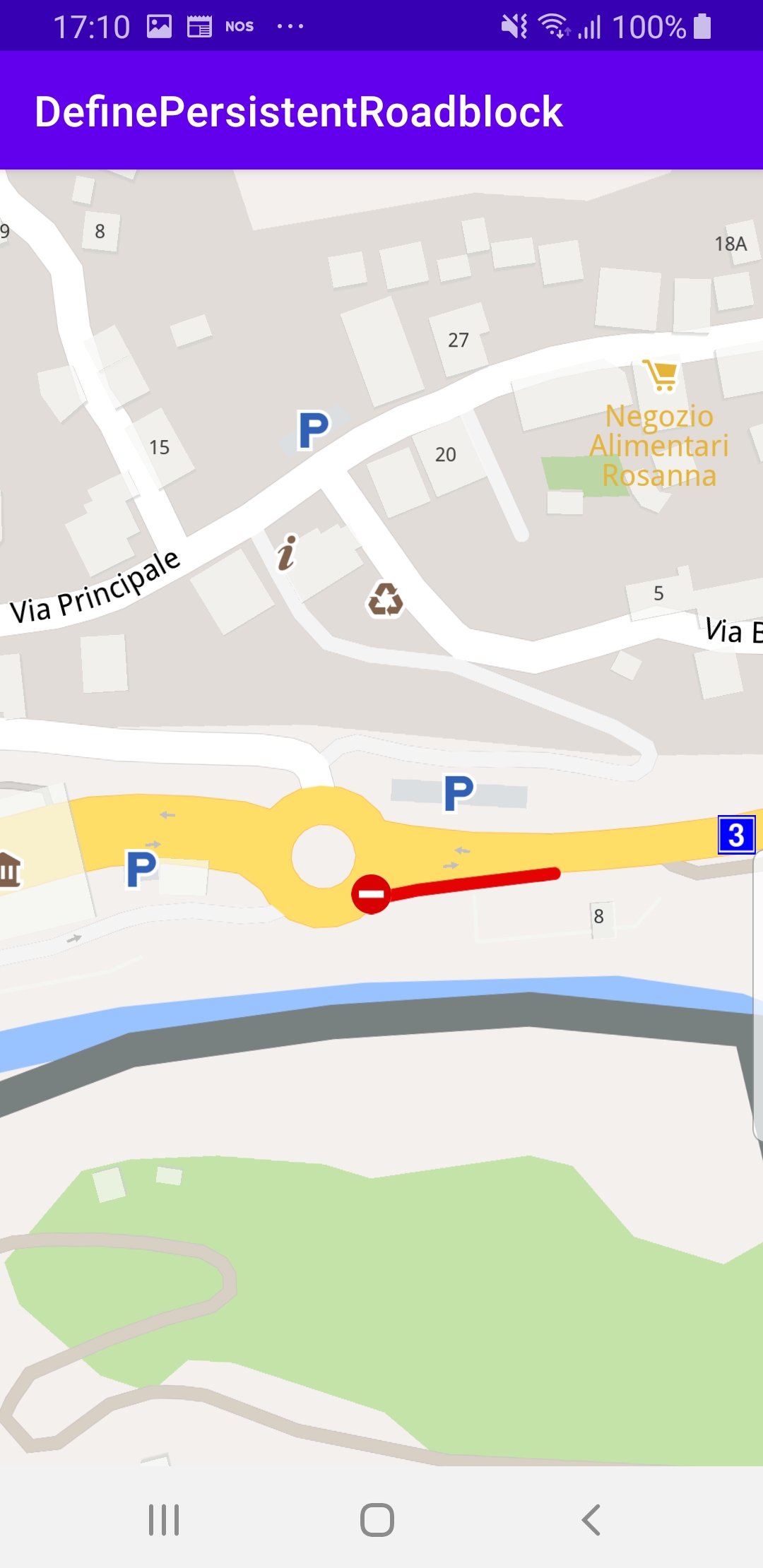
The selected road section is indicated with red roadblock polylines which may be on one or both sides of the road, depending on the road type.
Clicking on a different road section will move the roadblock there.
The map is interactive and fully 3D, supporting pan, pinch-zoom, rotate and tilt.
How it works
You can open the MainActivity.kt file and edit the search text as shown in the code block below, and run the app again to fly to a different area.

private var roadblock: TrafficEvent? = null
The roadblock variable is defined in the class MainActivity : AppCompatActivity() class to store the current section of road set as a roadblock by the user.
override fun onCreate(savedInstanceState: Bundle?)
{
   ...
         gemSurfaceView.mapView?.onTouch = { xy ->
             SdkCall.execute {
                 // tell the map view where the touch event happened
                 gemSurfaceView.mapView?.cursorScreenPosition = xy
                 val trafficEvents = gemSurfaceView.mapView?.cursorSelectionTrafficEvents
                 if (!trafficEvents.isNullOrEmpty())
                 {
                     val trafficEvent = trafficEvents[0]
                     if (trafficEvent.isRoadblock())
                     {
                         return@execute
                     }
                 }
                 val streets = gemSurfaceView.mapView?.cursorSelectionStreets
                 if (!streets.isNullOrEmpty())
                 {
                     streets[0].coordinates?.let { addPersistentRoadblock(it) }
                 }
             }
         }
   ...
}
In the class MainActivity : AppCompatActivity(), in the onCreate() function the x,y position of a user touch event is obtained using onTouch and set in cursorScreenPosition so the map can be queried about traffic events, if any, at that location.
If there are 1 or more traffic events at the touch location, if (!trafficEvents.isNullOrEmpty()) then the roadblock is set on the first traffic event in the list (at index 0).
val trafficEvent = trafficEvents[0]if (trafficEvent.isRoadblock())
Otherwise, if there are 1 or more road sections at the touch location,if (!streets.isNullOrEmpty())then the roadblock is set on the first street in the list (at index 0)streets[0].coordinates?.let { addPersistentRoadblock(it) }.
private fun addPersistentRoadblock(coordinates: Coordinates)
{
     val startTime = Time.getUniversalTime()
     val endTime = Time.getUniversalTime().also { endTime -> endTime?.let { it.minute += 1 } }
     if (startTime != null && endTime != null)
     {
         val traffic = Traffic()
         roadblock?.let { roadblock ->
             roadblock.referencePoint?.let { coordinates ->
                 traffic.removePersistentRoadblock(coordinates)
             }
         }
         roadblock = traffic.addPersistentRoadblock(
             coords = arrayListOf(coordinates),
             startUTC = startTime,
             expireUTC = endTime,
             transportMode = ERouteTransportMode.Car.value
         )
         if (roadblock?.referencePoint?.valid() == true)
         {
             roadblock?.boundingBox?.let {
                 gemSurfaceView.mapView?.centerOnArea(
                     area = it,
                     zoomLevel = -1,
                     xy = null,
                     animation = Animation(EAnimation.Linear)
                 )
             }
             Util.postOnMain { hint.visibility = View.GONE }
         }
     }
}
The addPersistentRoadblock() function gets the current time and sets the roadblock end time 1 minute into the future.
The roadblock class member variable is initially set to null, as we have seen above. Here it is checked and if it is not null, roadblock?.let { roadblock -> that means the user already set a previous roadblock.
In that case, the previous roadblock is removed first:
roadblock.referencePoint?.let { coordinates ->traffic.removePersistentRoadblock(coordinates) }
Then the new roadblock is added, and saved in the class member variable:roadblock = traffic.addPersistentRoadblock(coords = arrayListOf(coordinates),startUTC = startTime,expireUTC = endTime,transportMode = ERouteTransportMode.Car.value)
Finally, the camera flies to the bounding box enclosing the roadblock section to center it in the viewing area such that it fills the viewport:roadblock?.boundingBox?.let {gemSurfaceView.mapView?.centerOnArea(area = it,zoomLevel = -1,xy = null,animation = Animation(EAnimation.Linear))}
Android Examples
Maps SDK for Android Examples can be downloaded or cloned with Git.