Center Traffic
This example showcases how to build a Flutter app featuring an interactive map and how to center the camera on a route area with traffic, using the Maps SDK for Flutter.
How it works
The example app demonstrates the following features:
- Display an interactive map.
- Calculate a route.
- Center on a traffic segment.
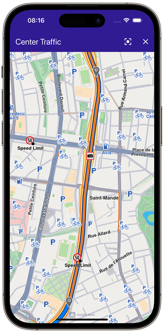 |
|---|
| Map camera centered traffic |
UI and Map Integration
The following code builds a UI with an interactive GemMap widget and an AppBar with buttons for computing a route, centering on traffic, and clearing the presented route.
const projectApiToken = String.fromEnvironment('GEM_TOKEN');
void main() {
runApp(const MyApp());
}
class MyApp extends StatelessWidget {
const MyApp({super.key});
Widget build(BuildContext context) {
return const MaterialApp(
debugShowCheckedModeBanner: false,
title: 'Center Traffic',
home: MyHomePage(),
);
}
}
class MyHomePage extends StatefulWidget {
const MyHomePage({super.key});
State<MyHomePage> createState() => _MyHomePageState();
}
class _MyHomePageState extends State<MyHomePage> {
late GemMapController _mapController;
// We use the handler to cancel the route calculation.
TaskHandler? _routingHandler;
Route? _route;
void dispose() {
GemKit.release();
super.dispose();
}
Widget build(BuildContext context) {
return Scaffold(
appBar: AppBar(
backgroundColor: Colors.deepPurple[900],
title: const Text(
'Center Traffic',
style: TextStyle(color: Colors.white),
),
actions: [
// Routes are not built.
if (_routingHandler == null && _route == null)
IconButton(
onPressed: () => _onBuildRouteButtonPressed(context),
icon: const Icon(Icons.route, color: Colors.white),
),
// Routes calculating is in progress.
if (_routingHandler != null)
IconButton(
onPressed: () => _onCancelRouteButtonPressed(),
icon: const Icon(Icons.stop, color: Colors.white),
),
// Routes calculating is finished.
if (_route != null)
IconButton(
onPressed: () => _centerOnTraffic(_route!),
icon: const Icon(Icons.center_focus_strong, color: Colors.white),
),
if (_route != null)
IconButton(
onPressed: () => _onClearRoutesButtonPressed(),
icon: const Icon(Icons.clear, color: Colors.white),
),
],
),
body: GemMap(
key: ValueKey("GemMap"),
onMapCreated: _onMapCreated,
appAuthorization: projectApiToken,
),
);
}
// The callback for when map is ready to use.
Future<void> _onMapCreated(GemMapController controller) async {
// Save controller for further usage.
_mapController = controller;
}
void _onBuildRouteButtonPressed(BuildContext context) {
// Define the departure.
final departureLandmark = Landmark.withLatLng(
latitude: 48.85682,
longitude: 2.34375,
);
// Define the destination.
final destinationLandmark = Landmark.withLatLng(
latitude: 50.84644,
longitude: 4.34587,
);
// Define the route preferences.
final routePreferences = RoutePreferences();
_showSnackBar(context, message: "The route is being calculated.");
// Calling the calculateRoute SDK method.
// (err, results) - is a callback function that gets called when the route computing is finished.
// err is an error enum, results is a list of routes.
_routingHandler = RoutingService.calculateRoute(
[departureLandmark, destinationLandmark],
routePreferences,
(err, routes) {
// If the route calculation is finished, we don't have a progress listener anymore.
_routingHandler = null;
ScaffoldMessenger.of(context).clearSnackBars();
// If there aren't any errors, we display the routes.
if (err == GemError.success) {
// Get the routes collection from map preferences.
final routesMap = _mapController.preferences.routes;
// Display the routes on map.
routesMap.add(routes.first, true);
// Center the camera on routes.
_mapController.centerOnRoute(routes.first);
setState(() {
_route = routes.first;
});
}
},
);
setState(() {});
}
void _centerOnTraffic(Route route) {
// Get the traffic events from the route.
final trafficEvents = route.trafficEvents;
if (trafficEvents.isEmpty) {
_showSnackBar(context, message: "No traffic events found.");
return;
}
final trafficEvent = trafficEvents.first;
// Center on first traffic event
_mapController.centerOnRouteTrafficEvent(trafficEvent, zoomLevel: 70);
}
void _onClearRoutesButtonPressed() {
// Remove the routes from map.
_mapController.preferences.routes.clear();
// Remove the highlights from map.
_mapController.deactivateAllHighlights();
setState(() {
_route = null;
});
}
void _onCancelRouteButtonPressed() {
// If we have a progress listener we cancel the route calculation.
if (_routingHandler != null) {
RoutingService.cancelRoute(_routingHandler!);
setState(() {
_routingHandler = null;
});
}
}
// Show a snackbar indicating that the route calculation is in progress.
void _showSnackBar(
BuildContext context, {
required String message,
Duration duration = const Duration(hours: 1),
}) {
final snackBar = SnackBar(content: Text(message), duration: duration);
ScaffoldMessenger.of(context).showSnackBar(snackBar);
}
}
Flutter Examples
Maps SDK for Flutter Examples can be downloaded or cloned with Git.