Add optimization where the stops have all fields set 
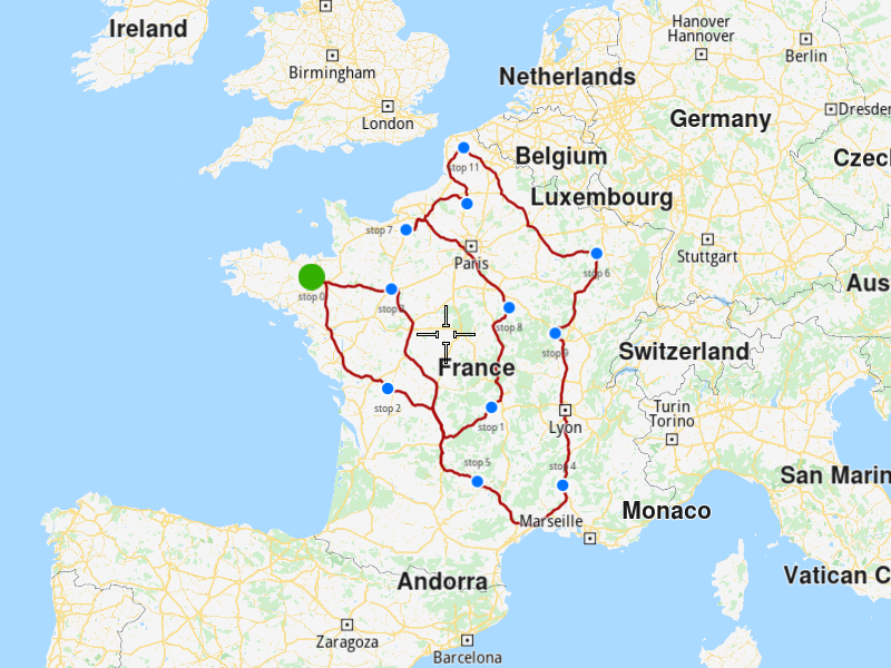
Add an optimization with stops that have all fields set and display the solution on the map.
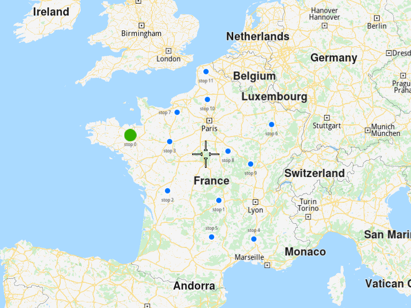
Use case 
- Create an optimization where for each stop can be set:
-
-
- the descriptive fields:
-
-
name
-
address
-
email
-
phone number
-
-
- the restrictive fields:
-
-
the type: pick up or delivery
-
the number of pieces, weight, and cube that have to be picked-up from it or delivered to it
-
the service time: how much time does the vehicle stay at this stop to do its job (ex: to unload the pieces)
-
the time window within which the stop must be visited
-
the revenue which has to be received from this stop
-
-
How to use the sample 
First, get an API key token, see the Getting Started guide.
Download the Maps & Navigation SDK for C++ archive file for Linux or WindowsWhen you run the sample, an optimization will be saved, the solution will be returned and showed on map.
How it works 
-
Create a
vrp::Stopfor each stop that has to be visited, set its fields and then add it into avrp::StopList. -
Create a
vrp::Optimizationand set the list created at 1.) to it. -
Create a
ProgressListener,vrp::Serviceandvrp::RouteList, in which the solution will be returned. -
Call the
addOptimization()method fromvrp::Serviceusing the list from 3.), thevrp::Optimizationfrom 2.) and the progress listener. -
Once the operation completes, the list from 3.) will contain the solution of the optimization.
To display the stops and route on the map 
-
Create a
MapServiceListener,OpenGLContextandMapView. -
Create a
LandmarkList,CoordinatesListandPolygonGeographicArea. -
Instruct the
MapViewto highlight theLandmarkListfrom 2.) to print the stops. -
Instruct the
MapViewto center on thePolygonGeographicArea. -
Create a
MarkerCollectionof typePolylineand add the route’s shape to it. -
Set the newly created
MarkerCollectionin the markers collections of the map view preferences. -
Allow the application to run until the map view is fully loaded.