Public Transit Calculate Route
- UIKit
This example demonstrates how to use GEMKit in a UIKit application to calculate a public transit route between two locations and render it on the map with a route summary.
Check the full implementation on GitHub.
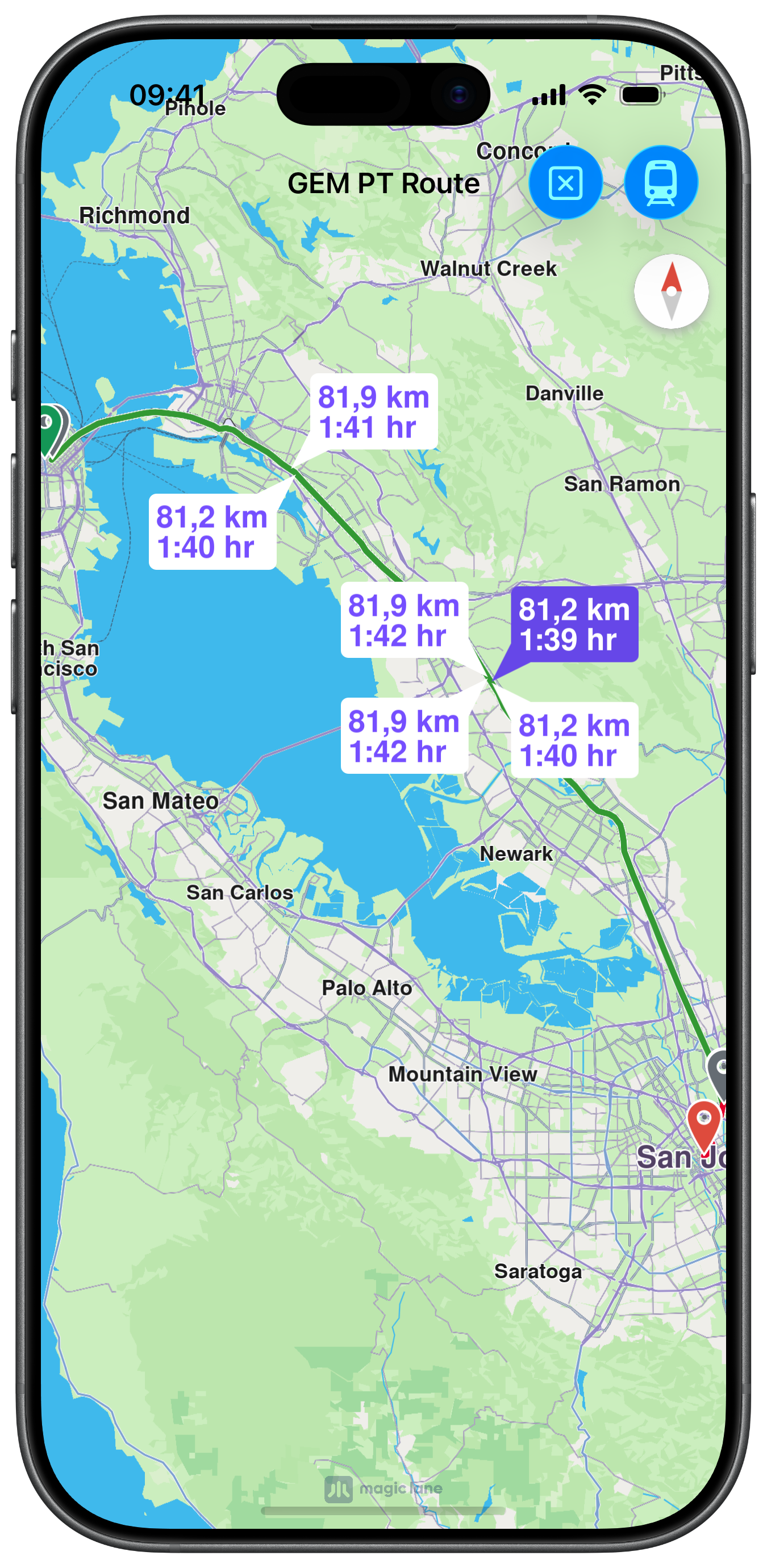
Public Transit Calculated Routes
UI and Map Integration
The view controller is minimal — a map view and a NavigationContext configured for public transit:
Calculating the Public Transit Route
Setting setTransportMode(.public) on the preferences switches the engine to the public transit planner. The result is presented on the map with a route summary:
info
For a public transport route the maximum number of waypoints is 2.