# Range Finder
Last updated:
October 18, 2026
\| 6 minutes read
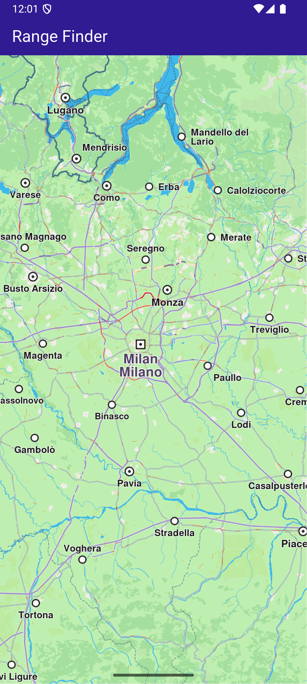
In this guide, you will learn how to implement route range calculation from a Point of Interest (POI) using the Maps SDK for Flutter. This example demonstrates how to display a map, tap on a landmark, and calculate route ranges based on different transport modes and preferences.
## How it Works[](#how-it-works "Direct link to How it Works")
This example demonstrates the following features:
* Allow users to interact with a map by tapping landmarks to focus on specific Points of Interest (POIs).
* Perform route range calculations from selected POIs using preferences such as transport mode.
### UI and Map Integration[](#ui-and-map-integration "Direct link to UI and Map Integration")
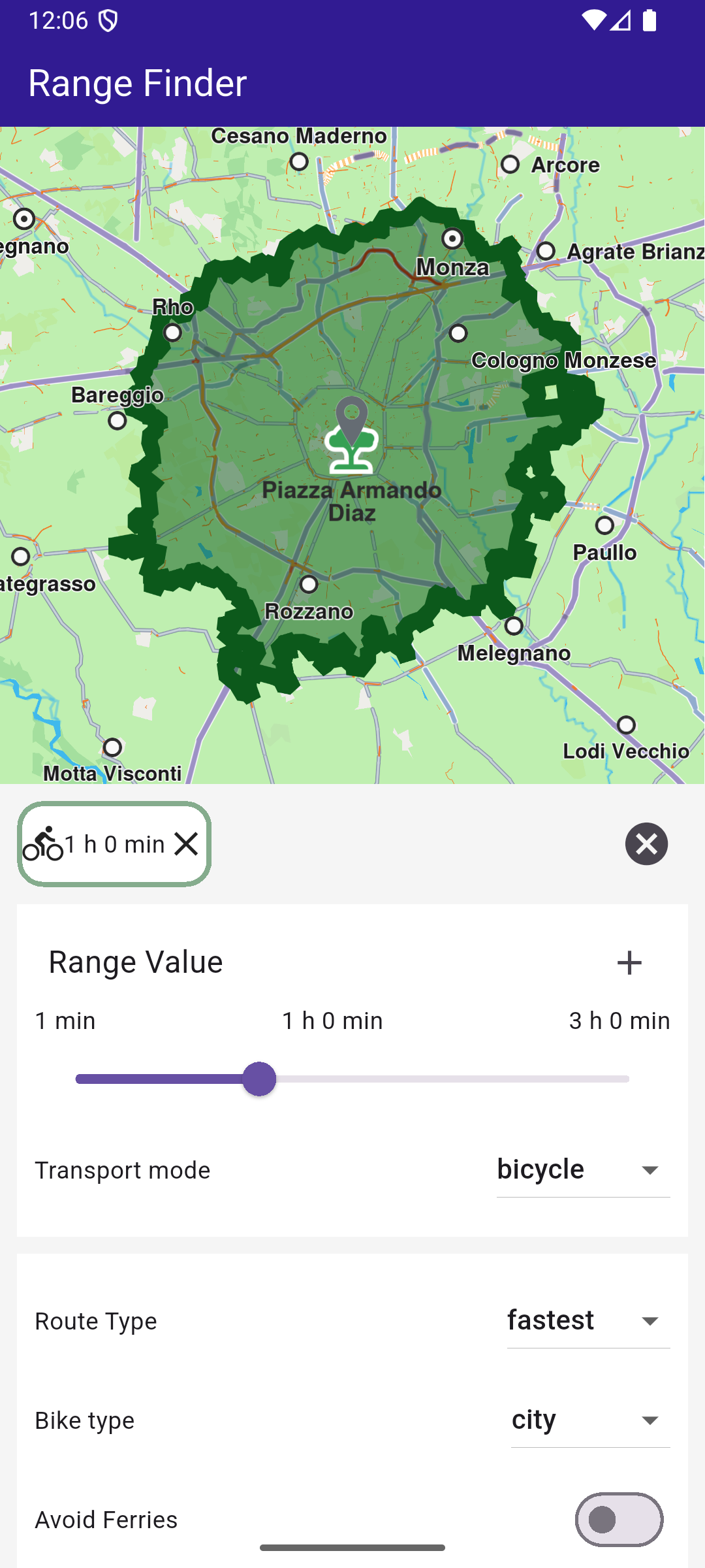
The following code creates a user interface featuring a `GemMap` widget and an app bar. When a Point of Interest (POI) is selected on the map, a range finder panel appears at the bottom of the screen.
Define the main application widget, MyApp.
main.dart[View on Github](https://github.com/magiclane/magiclane-maps-sdk-examples-for-flutter/tree/main/range_finder/lib/main.dart?ref_type=heads#L20)
```dart
class MyApp extends StatelessWidget {
const MyApp({super.key});
@override
Widget build(BuildContext context) {
return const MaterialApp(
debugShowCheckedModeBanner: false,
title: 'Range Finder',
home: MyHomePage(),
);
}
}
class MyHomePage extends StatefulWidget {
const MyHomePage({super.key});
@override
State createState() => _MyHomePageState();
}
```
Within \_MyHomePageState , define the necessary state variables and methods to interact with the map and manage routes.
main.dart[View on Github](https://github.com/magiclane/magiclane-maps-sdk-examples-for-flutter/tree/main/range_finder/lib/main.dart?ref_type=heads#L40)
```dart
class _MyHomePageState extends State {
late GemMapController _mapController;
Landmark? _focusedLandmark;
@override
void dispose() {
GemKit.release();
super.dispose();
}
@override
Widget build(BuildContext context) {
return Scaffold(
appBar: AppBar(
toolbarHeight: 50,
backgroundColor: Colors.deepPurple[900],
title: const Text(
'Range Finder',
style: TextStyle(color: Colors.white),
),
),
body: Stack(
children: [
GemMap(
key: ValueKey("GemMap"),
onMapCreated: _onMapCreated,
appAuthorization: projectApiToken,
),
if (_focusedLandmark != null)
Align(
alignment: Alignment.bottomCenter,
child: RangesPanel(
onCancelTap: _onCancelLandmarkPanelTap,
landmark: _focusedLandmark!,
mapController: _mapController,
),
),
],
),
);
}
// The callback for when map is ready to use.
Future _onMapCreated(GemMapController controller) async {
// Save controller for further usage.
_mapController = controller;
// Register route tap gesture callback.
await _registerLandmarkTapCallback();
}
Future _registerLandmarkTapCallback() async {
_mapController.registerOnTouch((pos) async {
// Select the object at the tap position.
await _mapController.setCursorScreenPosition(pos);
// Get the selected landmarks.
final landmarks = _mapController.cursorSelectionLandmarks();
// Reset the cursor position back to middle of the screen
await _mapController.resetMapSelection();
// Check if there is a selected Landmark.
if (landmarks.isEmpty) {
return;
}
// Highlight the selected landmark.
_mapController.activateHighlight(landmarks);
final lmk = landmarks[0];
setState(() {
_focusedLandmark = lmk;
});
// Use the map controller to center on coordinates.
_mapController.centerOnCoordinates(
lmk.coordinates,
zoomLevel: 70,
screenPosition: Point(
_mapController.viewport.width ~/ 2,
_mapController.viewport.height ~/ 3,
),
);
});
}
void _onCancelLandmarkPanelTap() {
// Remove landmark highlights from the map.
_mapController.deactivateAllHighlights();
_mapController.preferences.routes.clear();
setState(() {
_focusedLandmark = null;
});
}
}
```
### Range Calculation and Preferences[](#range-calculation-and-preferences "Direct link to Range Calculation and Preferences")
The RangesPanel widget handles the UI and logic for calculating and displaying route ranges. Here are the critical parts:
### Define State Variables[](#define-state-variables "Direct link to Define State Variables")
Define state variables to hold user preferences and the calculated route ranges.
ranges\_panel.dart[View on Github](https://github.com/magiclane/magiclane-maps-sdk-examples-for-flutter/tree/main/range_finder/lib/ranges_panel.dart?ref_type=heads#L32)
```dart
class _RangesPanelState extends State {
int _rangeValue = 3600;
RouteTransportMode _transportMode = RouteTransportMode.car;
RouteType _routeType = RouteType.fastest;
bool _avoidMotorways = false;
bool _avoidTollRoads = false;
bool _avoidFerries = false;
bool _avoidUnpavedRoads = false;
BikeProfile _bikeProfile = BikeProfile.city;
double _hillsValue = 0;
```
### Calculate Route Ranges[](#calculate-route-ranges "Direct link to Calculate Route Ranges")
Use the RoutingService to calculate route ranges based on user preferences.
ranges\_panel.dart[View on Github](https://github.com/magiclane/magiclane-maps-sdk-examples-for-flutter/tree/main/range_finder/lib/ranges_panel.dart?ref_type=heads#L347)
```dart
void _onAddRouteRangeButtonPressed(BuildContext context) {
if (!_doesRouteRangeExist()) {
_showSnackBar(context, message: "The route is being calculated.");
// Calling the calculateRoute SDK method.
// (err, results) - is a callback function that gets called when the route computing is finished.
// err is an error enum, results is a list of routes.
RoutingService.calculateRoute([widget.landmark], _getRoutePreferences(), (
err,
routes,
) {
ScaffoldMessenger.of(context).clearSnackBars();
// If there aren't any errors, we display the range.
if (err == GemError.success) {
// Get the routes collection from map preferences.
final routesMap = widget.mapController.preferences.routes;
// Color the range in a random color.
final randomColor = Color.fromARGB(
128,
Random().nextInt(200),
Random().nextInt(200),
Random().nextInt(200),
);
RouteRenderSettings settings = RouteRenderSettings(
fillColor: randomColor,
);
// Display the range on map.
routesMap.add(routes.first, true, routeRenderSettings: settings);
// Center the camera on range.
_centerOnRouteRange(routes.first);
setState(() {
_addNewRouteRange(routes.first, randomColor);
});
}
});
setState(() {});
}
}
```
**Calculated range within an one hour bike ride**
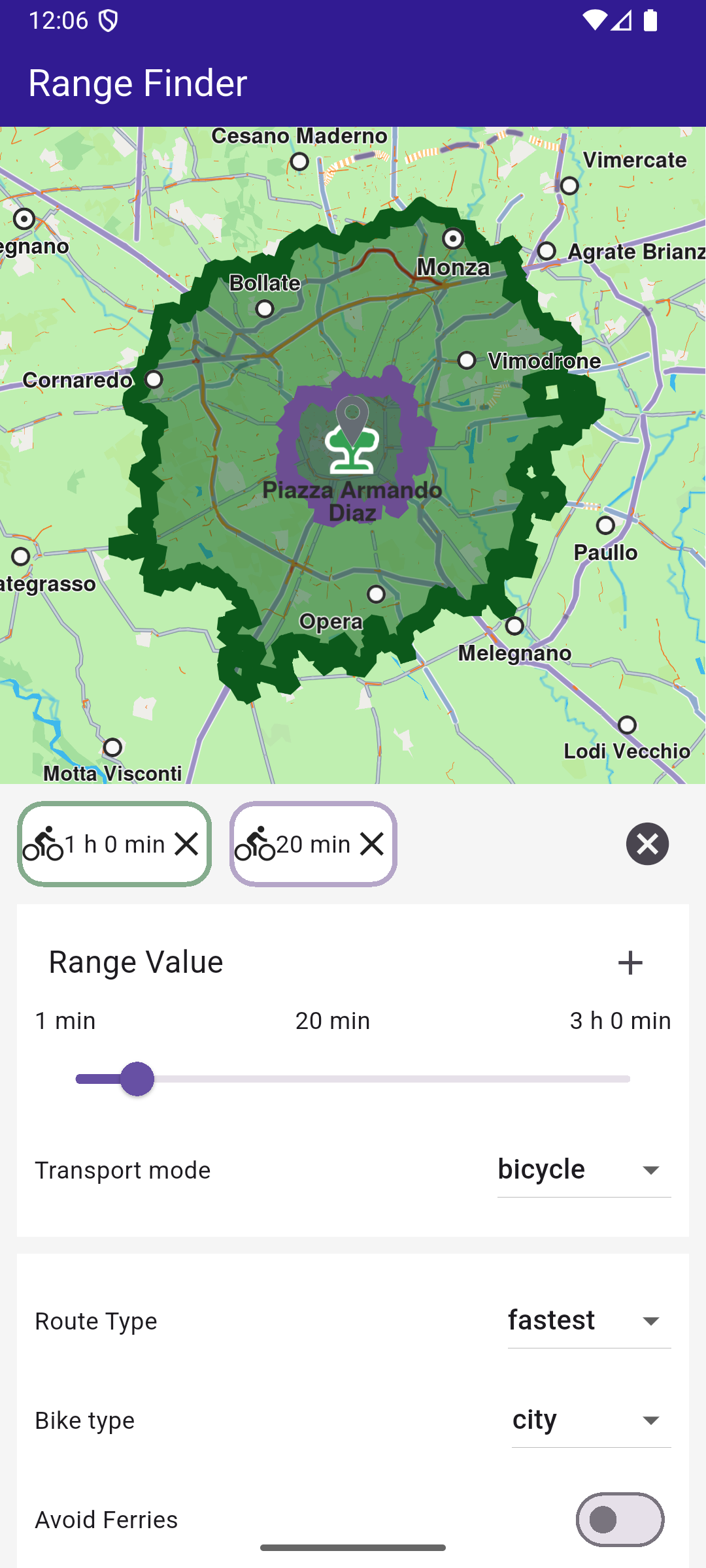
**Calculated range within 20 minute bike ride**
### Define Route Preferences[](#define-route-preferences "Direct link to Define Route Preferences")
Create a method to build route preferences based on user inputs.
ranges\_panel.dart[View on Github](https://github.com/magiclane/magiclane-maps-sdk-examples-for-flutter/tree/main/range_finder/lib/ranges_panel.dart?ref_type=heads#L299)
```dart
RoutePreferences _getRoutePreferences() {
// Get the preferences based on the selected transport mode.
switch (_transportMode) {
case RouteTransportMode.car:
return RoutePreferences(
avoidMotorways: _avoidMotorways,
avoidTollRoads: _avoidTollRoads,
avoidFerries: _avoidFerries,
avoidUnpavedRoads: _avoidUnpavedRoads,
transportMode: _transportMode,
routeType: _routeType,
routeRanges: [_rangeValue],
);
case RouteTransportMode.lorry:
return RoutePreferences(
avoidMotorways: _avoidMotorways,
avoidTollRoads: _avoidTollRoads,
avoidFerries: _avoidFerries,
avoidUnpavedRoads: _avoidUnpavedRoads,
transportMode: _transportMode,
routeType: _routeType,
routeRanges: [_rangeValue],
avoidTraffic: _trafficAvoidance,
);
case RouteTransportMode.pedestrian:
return RoutePreferences(
avoidFerries: _avoidFerries,
avoidUnpavedRoads: _avoidUnpavedRoads,
transportMode: _transportMode,
routeRanges: [_rangeValue],
);
case RouteTransportMode.bicycle:
return RoutePreferences(
avoidFerries: _avoidFerries,
avoidUnpavedRoads: _avoidUnpavedRoads,
transportMode: _transportMode,
routeType: _routeType,
routeRanges: [_rangeValue],
bikeProfile: BikeProfileElectricBikeProfile(
profile: _bikeProfile,
eProfile: ElectricBikeProfile(),
),
);
default:
return RoutePreferences();
}
}
```
### Handle User Interactions[](#handle-user-interactions "Direct link to Handle User Interactions")
Methods to manage user interactions, such as deleting, toggling, and centering on route ranges.
ranges\_panel.dart[View on Github](https://github.com/magiclane/magiclane-maps-sdk-examples-for-flutter/tree/main/range_finder/lib/ranges_panel.dart?ref_type=heads#L272)
```dart
void _deleteRouteRange(int index) {
// Remove the route range from map.
widget.mapController.preferences.routes.remove(routeRanges[index].route);
setState(() {
routeRanges.removeAt(index);
});
}
void _toggleRouteRange(int index) {
if (routeRanges[index].isEnabled) {
// If the route range is enabled, remove it from map.
widget.mapController.preferences.routes.remove(routeRanges[index].route);
return;
} else {
// If the route range is disabled, display it on map and center on it.
RouteRenderSettings settings = RouteRenderSettings(
fillColor: routeRanges[index].color,
);
widget.mapController.preferences.routes.add(
routeRanges[index].route,
true,
routeRenderSettings: settings,
);
_centerOnRouteRange(routeRanges[index].route);
}
}
String _getRouteRangeValueString() {
final String valueString = (_routeType == RouteType.fastest)
? convertDuration(_rangeValue)
: (_routeType == RouteType.economic)
? convertWh(_rangeValue)
: convertDistance(_rangeValue);
return valueString;
}
bool _doesRouteRangeExist() {
bool exists = routeRanges.any(
(range) =>
range.transportMode == _transportMode &&
range.value == _getRouteRangeValueString(),
);
return exists;
}
void _addNewRouteRange(Route route, Color color) {
Range newRange = Range(
route: route,
color: color,
transportMode: _transportMode,
value: _getRouteRangeValueString(),
isEnabled: true,
);
routeRanges.add(newRange);
}
void _centerOnRouteRange(Route route) {
const appbarHeight = 50;
const padding = 20;
// Use the map controller to center on route above the panel.
widget.mapController.centerOnRoute(
route,
screenRect: Rectangle(
0,
(appbarHeight + padding * MediaQuery.of(context).devicePixelRatio)
.toInt(),
(MediaQuery.of(context).size.width *
MediaQuery.of(context).devicePixelRatio)
.toInt(),
((MediaQuery.of(context).size.height / 2 -
appbarHeight -
2 * padding * MediaQuery.of(context).devicePixelRatio) *
MediaQuery.of(context).devicePixelRatio)
.toInt(),
),
);
}
// Show a snackbar indicating that the route calculation is in progress.
void _showSnackBar(
BuildContext context, {
required String message,
Duration duration = const Duration(hours: 1),
}) {
final snackBar = SnackBar(content: Text(message), duration: duration);
ScaffoldMessenger.of(context).showSnackBar(snackBar);
}
```
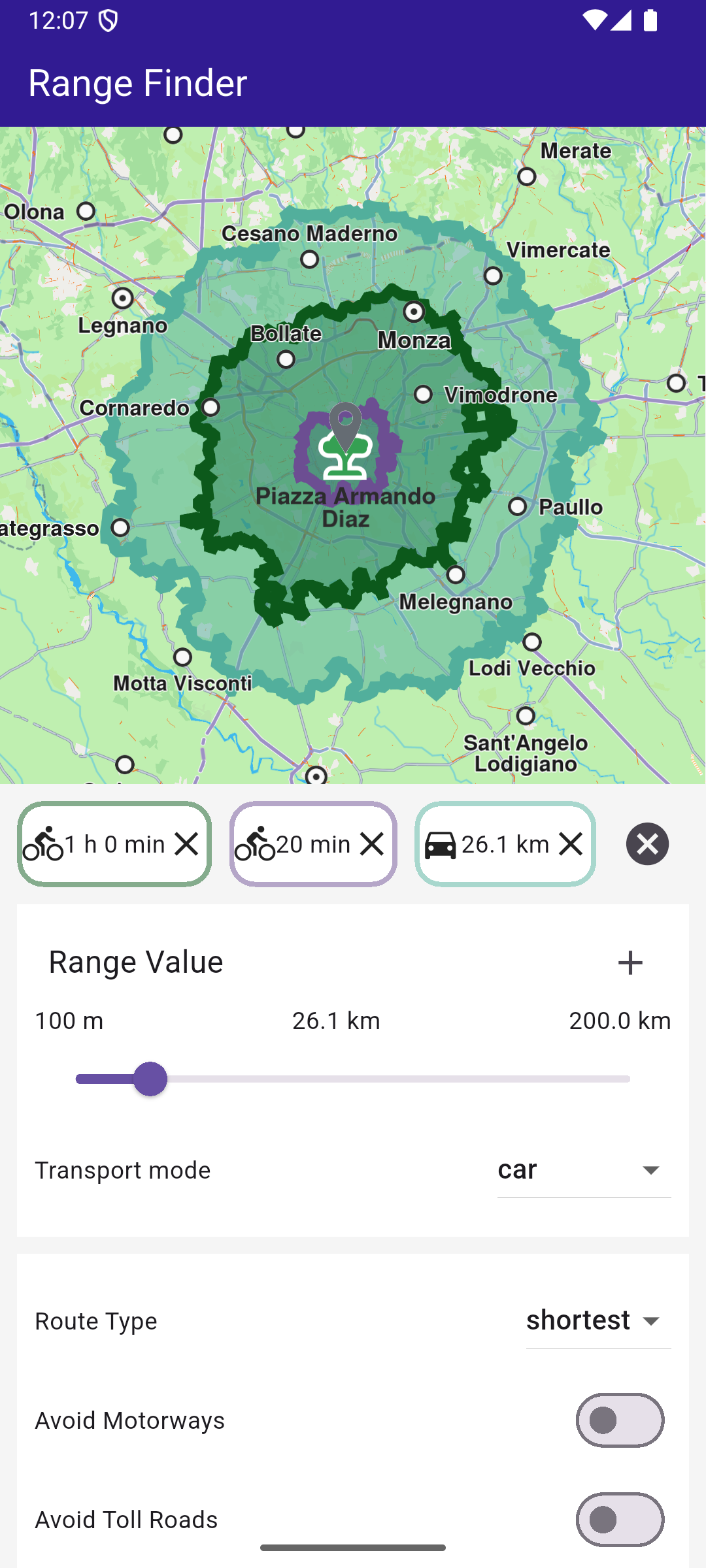
You can start calculating a range by tapping the + button after adjusting your specifications for the routes.