# Marker Clustering
Last updated:
October 18, 2026
\| 5 minutes read
This example demonstrates how to render thousands of markers loaded from a bundled GeoJSON file and cluster them natively using Maps SDK for Flutter. At low zoom the markers group into count "pill" bubbles; as you zoom in the clusters break apart into per-type coloured pins. Tapping a cluster zooms in to split it, and tapping a pin opens an info sheet.
## Dependencies[](#dependencies "Direct link to Dependencies")
This example requires **Maps SDK for Flutter 3.1.10** or newer. Add it to the `dependencies` section of your `pubspec.yaml`:
```yaml
dependencies:
magiclane_maps_flutter: ^3.1.10
```
## Saving Assets[](#saving-assets "Direct link to Saving Assets")
Before running the app, ensure that you save the campsite data and pin icons into the assets directory:
* `assets/campsites.geojson` — the marker source data
* `assets/pin_bookable.png` — red pin, bookable campsites
* `assets/pin_non_bookable.png` — green pin, info-only campsites
Update your `pubspec.yaml` file to include these assets:
```yaml
flutter:
assets:
- assets/campsites.geojson
- assets/pin_bookable.png
- assets/pin_non_bookable.png
```
## How it works[](#how-it-works "Direct link to How it works")
The map uses **two overlapping SDK-drawn marker collections**. A marker that carries its own per-marker render settings suppresses the SDK's cluster count label, so the count and the coloured pins cannot come from a single collection:
* **Cluster layer** — one point-marker per campsite with collection-level settings only. The SDK groups the points into density "pill" bubbles and paints the count on them; loose points draw a transparent image.
* **Detail layer** — one coloured green/red pin per campsite added through the SDK's optimised bulk `addList(...)` path. Its group images are transparent, so it shows nothing while clustered and only its pins once the clusters split.
Both collections group at the same zoom level, so a pill never sits on top of a pin.
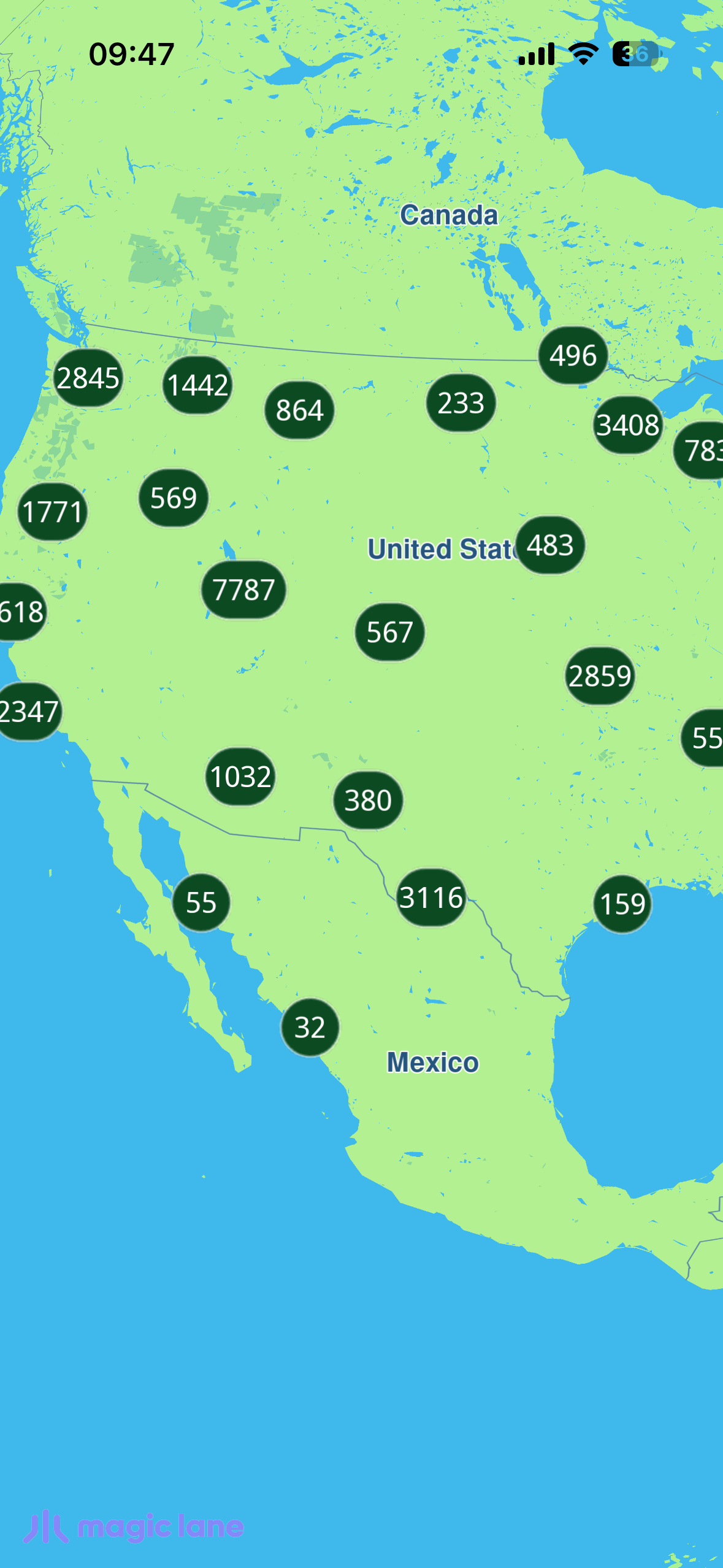
**Clustered markers**
### UI and Map Integration[](#ui-and-map-integration "Direct link to UI and Map Integration")
This code sets up the map screen, enables the (invisible) cursor so a tap can select a marker, and centers the camera on the initial view.
main.dart[View on Github](https://github.com/magiclane/magiclane-maps-sdk-examples-for-flutter/tree/main/marker_clustering/lib/main.dart?ref_type=heads#L37)
```dart
class MyApp extends StatelessWidget {
const MyApp({super.key});
@override
Widget build(BuildContext context) {
return const MaterialApp(
debugShowCheckedModeBanner: false,
title: 'Marker Clustering',
home: MapScreen(),
);
}
}
Future _onMapCreated(GemMapController controller) async {
_controller = controller;
// Enable the (invisible) cursor so tap → marker selection works.
controller.preferences.enableCursor = true;
controller.preferences.enableCursorRender = false;
controller.centerOnCoordinates(_usCenter, zoomLevel: _usZoom);
controller.registerOnTouch(_onTouch);
}
```
### Loading and parsing the GeoJSON[](#loading-and-parsing-the-geojson "Direct link to Loading and parsing the GeoJSON")
The bundled GeoJSON is read from assets and decoded on a background isolate (`compute`) so the multi-MB parse never janks the UI thread.
campsite.dart[View on Github](https://github.com/magiclane/magiclane-maps-sdk-examples-for-flutter/tree/main/marker_clustering/lib/campsite.dart?ref_type=heads#L74)
```dart
class CampsiteLoader {
static Future> loadFromAssets(
[String asset = 'assets/campsites.geojson']) async {
final raw = await rootBundle.loadString(asset);
return compute(_parse, raw);
}
static List _parse(String raw) {
final root = jsonDecode(raw) as Map;
final features = (root['features'] as List?) ?? const [];
final result = [];
for (final feature in features) {
final f = feature as Map;
final geometry = f['geometry'] as Map?;
final coords = geometry?['coordinates'] as List?;
final props = f['properties'] as Map?;
if (coords == null || coords.length < 2 || props == null) continue;
result.add(Campsite(
id: _asInt(props['campsiteId'])!,
name: (props['name'] as String?) ?? '',
isBookable: props['bookable'] == true,
latitude: _asDouble(coords[1])!,
longitude: _asDouble(coords[0])!,
// ...
));
}
return result;
}
}
```
### The cluster layer (count "pill" bubbles)[](#the-cluster-layer-count-pill-bubbles "Direct link to The cluster layer (count \"pill\" bubbles)")
The first collection holds one point-marker per campsite with collection-level settings only. `buildPointsGroupConfig` plus the density images and count thresholds make the SDK group loose points into count-bearing pills. Note that `labelGroupTextColor` defaults to transparent — it must be set opaque or the count is invisible.
main.dart[View on Github](https://github.com/magiclane/magiclane-maps-sdk-examples-for-flutter/tree/main/marker_clustering/lib/main.dart?ref_type=heads#L146)
```dart
final clusterCollection = MarkerCollection(
markerType: MarkerType.point,
name: '$_collectionName-clustered',
);
for (final c in campsites) {
clusterCollection.add(
Marker.fromCoords(
[Coordinates(latitude: c.latitude, longitude: c.longitude)]),
);
}
final clusterSettings = MarkerCollectionRenderSettings(
pointsGroupingZoomLevel: _clusterZoom,
buildPointsGroupConfig: true,
lowDensityPointsGroupImage: assets.lowPill,
mediumDensityPointsGroupImage: assets.mediumPill,
highDensityPointsGroupImage: assets.highPill,
lowDensityPointsGroupMaxCount: 200,
mediumDensityPointsGroupMaxCount: 4000,
labelGroupTextSize: 2.7,
labelingMode: const {
MarkerLabelingMode.groupLabelVisible,
MarkerLabelingMode.groupCenter,
},
);
// Count colour defaults to transparent — set it opaque, or the count is invisible.
clusterSettings.labelGroupTextColor = const Color(0xFFFFFFFF);
clusterSettings.imageSize = 5.8;
clusterSettings.image = assets.transparent; // loose singles invisible
controller.preferences.markers
.add(clusterCollection, settings: clusterSettings);
```
### The detail layer (coloured pins)[](#the-detail-layer-coloured-pins "Direct link to The detail layer (coloured pins)")
The second collection carries one green/red pin per campsite through the optimised bulk `addList(...)` path. Its group images are transparent, so while clustered it shows nothing and the cluster layer's pills show instead; once the clusters split its pins appear.
main.dart[View on Github](https://github.com/magiclane/magiclane-maps-sdk-examples-for-flutter/tree/main/marker_clustering/lib/main.dart?ref_type=heads#L195)
```dart
final markers = [];
for (final c in campsites) {
markers.add(
MarkerWithRenderSettings(
MarkerJson(
coords: [Coordinates(latitude: c.latitude, longitude: c.longitude)],
name: c.markerName,
),
MarkerRenderSettings(
image: assets.pinFor(bookable: c.isBookable),
imageSize: 6.0,
labelingMode: const {MarkerLabelingMode.iconBottomCenter},
),
),
);
}
final detailSettings = MarkerCollectionRenderSettings(
pointsGroupingZoomLevel: _clusterZoom,
// Transparent group images → nothing shown while clustered.
lowDensityPointsGroupImage: assets.transparent,
mediumDensityPointsGroupImage: assets.transparent,
highDensityPointsGroupImage: assets.transparent,
labelGroupTextSize: 0,
labelingMode: const {MarkerLabelingMode.iconBottomCenter},
);
await controller.preferences.markers.addList(
list: markers,
settings: detailSettings,
name: '$_collectionName-detail',
);
```
As you zoom in, the clusters break apart: smaller count pills give way to the individual green (info-only) and red (bookable) pins.
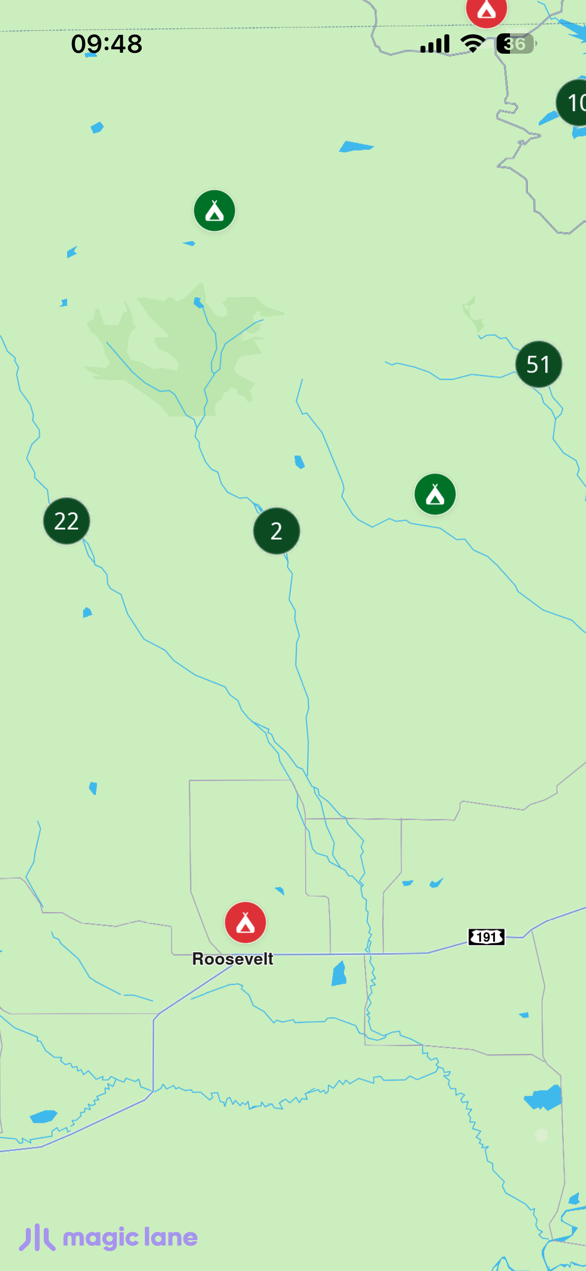
**Clusters breaking apart into pins**
### Handling taps[](#handling-taps "Direct link to Handling taps")
On touch, the cursor position is set (awaited) before reading the selection. A `coordinateGroup` match means a cluster was tapped — zoom in toward the tap to break it apart. Otherwise a single campsite was tapped — center on it and show its info sheet.
main.dart[View on Github](https://github.com/magiclane/magiclane-maps-sdk-examples-for-flutter/tree/main/marker_clustering/lib/main.dart?ref_type=heads#L242)
```dart
Future _onTouch(Point pos) async {
await controller.setCursorScreenPosition(pos);
final matches = controller.cursorSelectionMarkers();
if (matches.isEmpty) return;
final isCluster =
matches.any((m) => m.type == MarkerMatchType.coordinateGroup);
if (isCluster) {
final target = (controller.zoomLevel + 12).clamp(0, 90).toInt();
controller.centerOnCoordinates(
controller.transformScreenToWgs(pos),
zoomLevel: target,
animation: GemAnimation(type: AnimationType.linear, duration: 500),
);
return;
}
// Single campsite → decode metadata and show the info sheet.
final marker = matches.first.marker;
final info = Campsite.decodeMarkerName(marker.name);
// ... center on it and setState to show _InfoSheet
}
```
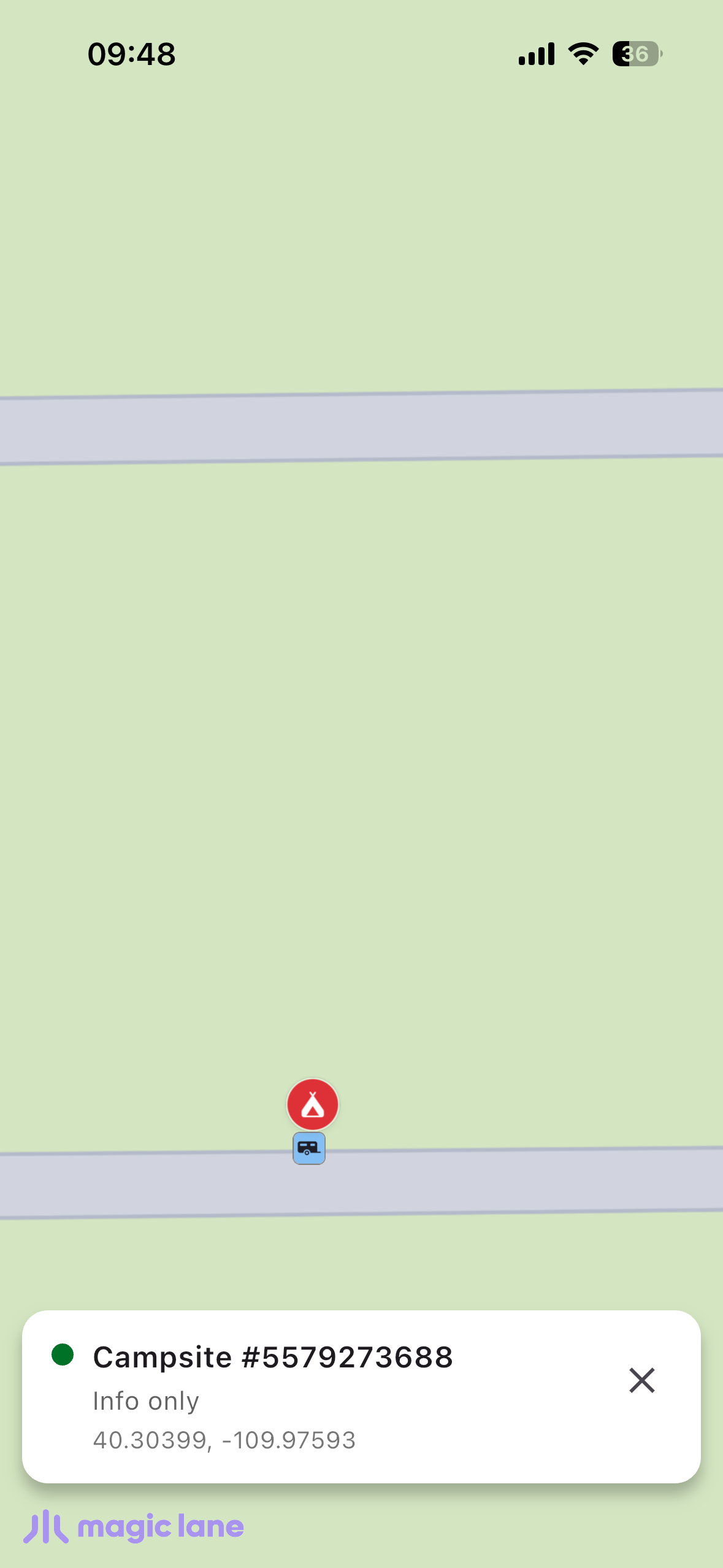
**Coloured pins and info sheet**